1863 Gettysburg Pennsylvania Civil War Battlefield Map Union Confederacy - 24x36


When you click on links to various merchants on this site and make a purchase, this can result in this site earning a commission. Affiliate programs and affiliations include, but are not limited to, the eBay Partner Network.

1863 Gettysburg Pennsylvania Civil War Battlefield Map Union Confederacy - 24x36:
$1995.00
NEW PRICE & PHOTOS. Manufactured by S. H. Colesworthy, Portland Maine, 1863, GETTYSBURG BATTLE-FIELD, published by Jno. B. Bachelder, printed by Endicott & Co., Litho., New York, Heliotype Printing Company. A Birdseye View of the Positions of the Confederate & Union Armies on July 1, 2 & 3, 1863, as Commanded by General G G Meade and General Robert E Lee, Little Round Top, the Devil's Den, etc. Representative of 25 square miles of territory that includes Federal Confederate Signal Station and Corps Badges. Incredible amount of detail, troop positions with commanding officers, topo information. Image is 20" high x 32" wide. Exquisite original walnut frame is 33 x 45 inches overall and in excellent original condition.S N Colesworthy, Portland Maine, 69 Exchange Street, with the original tag still secure. Well cared for walnut frame has a superb patina, gilt decorated, original wood plank backing with a later hanging strip, as shown. $49.95 Continental USA shipping only. Imperfections as shown, see photos. We ship treasures daily!
1863 Gettysburg Pennsylvania Civil War Battlefield Map Union Confederacy - 24x36:
$1995.00
Related Items:
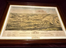
1863 Gettysburg July 1, 2, 3, “Birds Eye View” by Bachelder Civil War Map
$15900.00

1863 Union Officer Commission & Field Report from 17th CT Regiment at Gettysburg
$7500.00
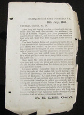
CIVIL WAR GETTYSBURG CONFEDERATE ORIGINAL ORDER LEE TO HIS MEN 11TH JULY, 1863
$4500.00